


Japanese Woodcut Map of the Japanese Islands
Similar Sale History
View More Items in Maps & Atlases![1943 US Air Force Silk Escape Map of Northern Honsu: Title/Content of Map: 1943 US Army Air Force Silk Escape Map of Northern Honsu (main island) and Hokkado Islands, Japan -- [Escape Silk Map] Hakodate [verso] Nemuro Date Printed: 1943, Washington DC C](https://p1.liveauctioneers.com/5584/117342/60336934_1_x.jpg?height=310&quality=70&version=1520389291)
![Johnston: Antique Map of China & Japan, 1879: Title/Content of Map: 'China and Japan [inset: Islands of Japan]' Date Printed: 1879 Image Size: Approx 47.5 x 61.0cm, 18.75 x 24 inches (Large); Please note that this is a folding map. Type: Large, f](https://p1.liveauctioneers.com/5584/108292/55552456_1_x.jpg?height=310&quality=70&version=1503667951)


Related Maps & Atlases
![China.- Jansson (Jan) China Veteribus Sinarum Regio nunc Incolis Tame dicta, engraved map, [c. 1635]: China.- Jansson (Jan) China Veteribus Sinarum Regio nunc Incolis Tame dicta, map of Eastern China, with Japan, Korea as an island, and the northern Philippines, with large decorative title cartouche s](https://p1.liveauctioneers.com/5458/332455/179303772_1_x.jpg?height=310&quality=70&version=1717586421)


![Ortelius map of Tartary with part of America: Heading: Author: Ortelius, Abraham Title: Tartariae Sive Magni Chami Regni Typus Place Published: Antwerp Publisher: Date Published: 1570-[1584] Description: Engraved map, full col](https://p1.liveauctioneers.com/642/332628/179408760_1_x.jpg?height=310&quality=70&version=1717729056)
![Mercator's map of China 1606: Heading: (China, Korea & Japan) Author: Mercator, Gerard Title: China Place Published: [Antwerp] Publisher: Date Published: [1606 - printed later] Description: Copper-engraved map,](https://p1.liveauctioneers.com/642/332628/179408748_1_x.jpg?height=310&quality=70&version=1717729056)


More Items in Maps & Atlases
View More
![[Maps & Atlases] Oliva, Joan: Portolan Chart of the Mediterranean: [Maps & Atlases] Oliva, Joan: Portolan Chart of the Mediterranean Oliva, Joan Portolan Chart of the Mediterranean Marseille, 1615. Illuminated manuscript portolan chart on vellum, in red, blue, green,](https://p1.liveauctioneers.com/65/332523/179335172_1_x.jpg?height=310&quality=70&version=1717709445)


![Set of Twelve Satirical Anthropomorphic Maps of Europe: [SATIRICAL MAPS] A set of twelve satirical anthropomorphic maps of Europe. London: circa 1868. A set of 12 (believed complete) lithographed maps by Vincent Brooks, Day & Son, London, each offering](https://p1.liveauctioneers.com/292/330597/178279264_1_x.jpg?height=310&quality=70&version=1716409282)


Recommended Transportation & Travel Collectibles
View More


Item Details
Description
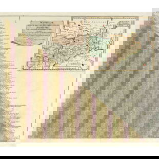
Circa 1840 A.D. Antique woodcut map of lower Japanese islands (Kyushu, Shikoku, Honshu) with very extensive detail depicting towns, villages, temples; coloured, and with an extensive key; some water stains, frayed edges. 41 grams total, 219 x 36 cm (86 1/4 x 14 1/8 in.).
Acquired from the UK art market. Private Scottish collection.
Acquired from the UK art market. Private Scottish collection.
Buyer's Premium
- 35%
Japanese Woodcut Map of the Japanese Islands
Estimate £120 - £170
10 bidders are watching this item.
Shipping & Pickup Options
Item located in Harwich, Essex, ukSee Policy for Shipping
Local Pickup Available
Payment

TOP