


New York, Central Park, 1860 map
Similar Sale History


Recommended Items


![Central Park Lake [New York City]: Sitting By The Lake In Central Park [New York City] Artist: Chang Yee Print Type: Color Halftone Signed: In plate Dimensions: 8 3/4 x 5" Subject: New York City](https://p1.liveauctioneers.com/5614/332486/179314239_1_x.jpg?height=310&quality=70&version=1717612636)


Item Details
Description
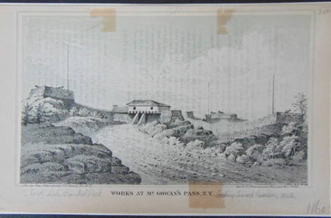
Map of the Central Park showing the progress of the work up to January 1st, 1860, Fred. Law Olmsted Architect in Chief; Calvert Vaux, Consulting architect, sheet measures 8 3/4"H x 38"L, clean hand-colored map, small handwritten notation and small stain on upper left corner within area of text. Hardcovers with waterstain.
Buyer's Premium
- 21%
New York, Central Park, 1860 map
Estimate $200 - $400
2 bidders are watching this item.
Shipping & Pickup Options
Item located in Kennebunk, ME, usSee Policy for Shipping
Payment

TOP